About All Tours Stargazing ToursAnd Zion ToursFrom Las Vegas ToursSelf-Guided Driving ToursHorseback Riding ToursScenic ToursZion Self-Guided ToursHelicopter Tours Directions Hours & Fees
Find Tours 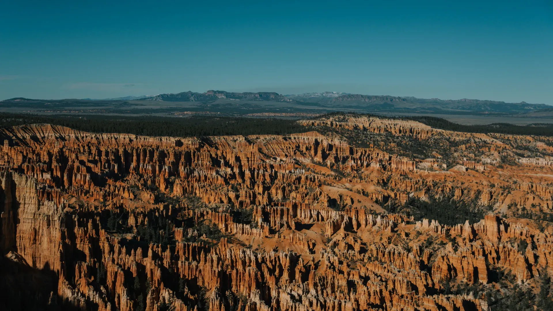
Bryce Canyon National Park occupies 35,835 acres on the eastern edge of Utah's Paunsaugunt Plateau. Thousands of tall, red-rock spires called hoodoos rise from a series of horseshoe-shaped amphitheaters carved into the high desert.
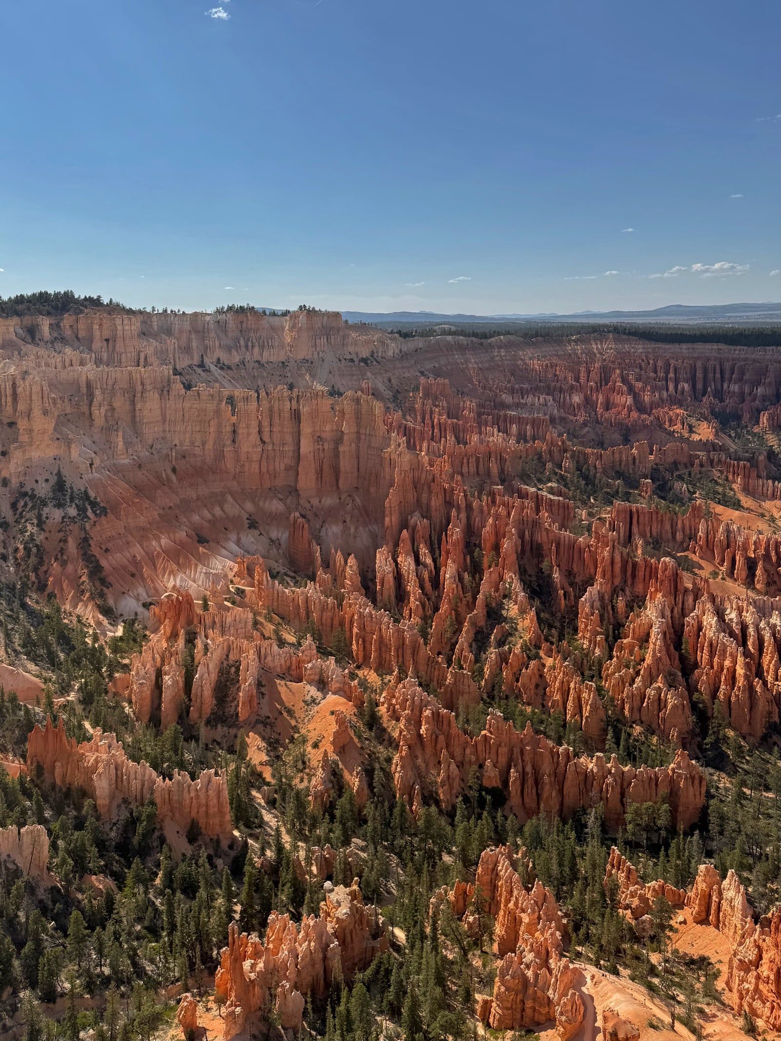
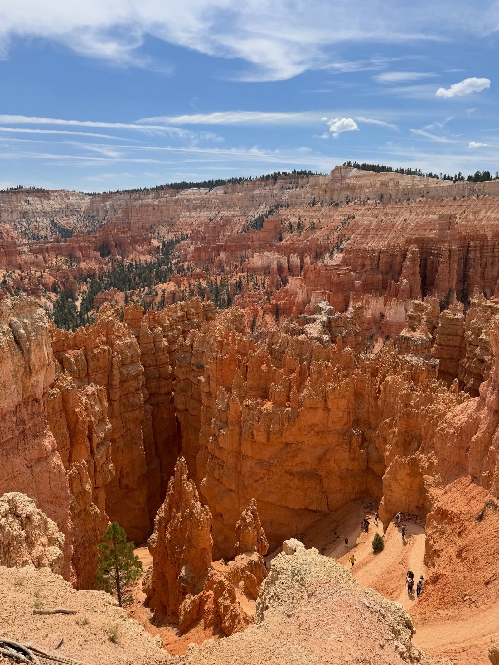
Bryce Canyon National Park occupies 35,835 acres of rugged terrain on the eastern edge of the Paunsaugunt Plateau in south-central Utah. Frost and rainwater have eroded the Claron Formation here into the world's largest collection of hoodoos. These tall, skinny spires of calcium-rich mudstone protrude from arid basins, colored red, orange, and white by iron and manganese minerals. The park does not contain a single main canyon. It features a series of horseshoe-shaped natural amphitheaters carved into the plateau edge instead. Elevations range from 8,000 feet at the northern boundary to 9,115 feet at Rainbow Point, creating a high-altitude environment where the air is thin and temperatures drop rapidly.
Visitors walking the 5.5-mile Rim Trail look down on thousands of tightly packed rock spires. Gusty mountain winds whip across the exposed limestone edges. Below the rim, trails like the three-mile Queens Garden and Navajo Loop descend via steep switchbacks directly into the hoodoo forest. Hikers wind past massive rock fins and towering formations like Thor's Hammer before climbing back to the plateau surface. The paved section of the Rim Trail between Sunset and Sunrise Points provides wheelchair-friendly access to the canyon edge. Older visitors and families with strollers can utilize 14 accessible overlooks, many featuring level, paved paths directly from the parking lots.
Summer monsoon storms in July and August build rapidly by noon. The towering hoodoos act as natural lightning rods, making the exposed rim dangerous during afternoon thunderstorms. Winter brings freezing temperatures, with daytime highs rarely breaking 40°F. Heavy snow covers the red rocks from November through March, forcing temporary road closures and limiting facility hours. May and September offer daytime temperatures in the 60s and 70s, full shuttle operations, and clear access to the 18-mile scenic drive. Drivers traveling the 270 miles from Salt Lake City or 248 miles from Las Vegas pay a $35 entrance fee at the gate. Visitors arriving during peak months should park at the Shuttle Station in Bryce Canyon City to bypass the congested lots at the main amphitheater viewpoints.
Sedimentary layers deposited in ancient lakes, deserts, and seas over 525 million years form the foundation of the Paunsaugunt Plateau. The park sits on the top step of the Grand Staircase, a massive geological sequence stretching south into Arizona. The uppermost layer, known as the Claron Formation, consists of calcium-rich mudstone laid down between 30 and 40 million years ago. Tectonic uplift eventually raised the entire Colorado Plateau, exposing these ancient lakebeds to the erosional forces of wind, water, and ice.
Mormon pioneers arrived in the late 1800s to graze cattle in the surrounding valleys and extract timber from the high-altitude forests. Ebenezer Bryce, a Scottish-born carpenter, homesteaded in the area in 1874. He constructed a timber road to the plateau rim to make logging operations more efficient. Locals began referring to the horseshoe-shaped amphitheater behind his home as Bryce's Canyon. Bryce famously described the rugged landscape of hoodoos and dead-end slot canyons as a terrible place to lose a cow. He relocated his family to Arizona in 1880, but his name remained attached to the geological feature.
Early 20th-century conservationists recognized the unusual scenic value of the hoodoos. President Warren G. Harding established Bryce Canyon National Monument on June 8, 1923. He utilized the Antiquities Act to protect the fragile spires from unregulated tourism, logging, and overgrazing. Congress upgraded the site's status shortly after, and it operated briefly as Utah National Park in 1924. Under President Calvin Coolidge's administration, the area officially became Bryce Canyon National Park on February 25, 1928. The Union Pacific Railroad expanded its passenger service to southern Utah during this era, constructing lodges and promoting the park to eastern tourists.
Infrastructure expanded throughout the mid-1900s to handle growing automobile tourism. The Civilian Conservation Corps built trails, campgrounds, and administrative buildings during the Great Depression. Many of these structures remain in use today. Park management shifted focus toward environmental preservation in recent decades. Bryce Canyon earned certification as an International Dark Sky Park in 2019, implementing strict lighting protocols to protect its night skies from light pollution. Today, more than 2.3 million people visit the park annually. Backpackers seeking overnight access to the remote Under the Rim Trail must obtain permits via Recreation.gov up to three months in advance.
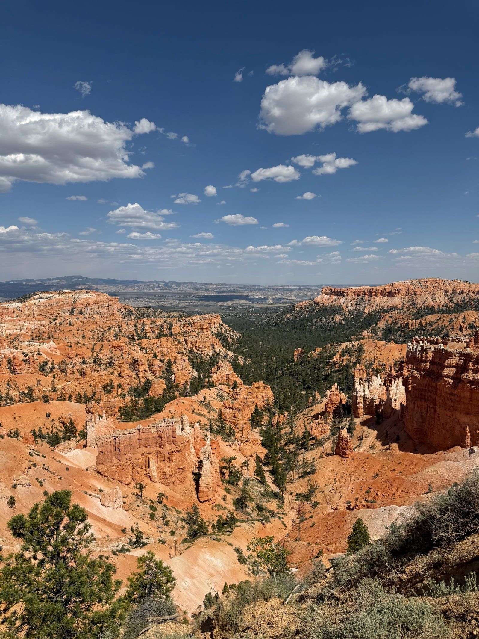
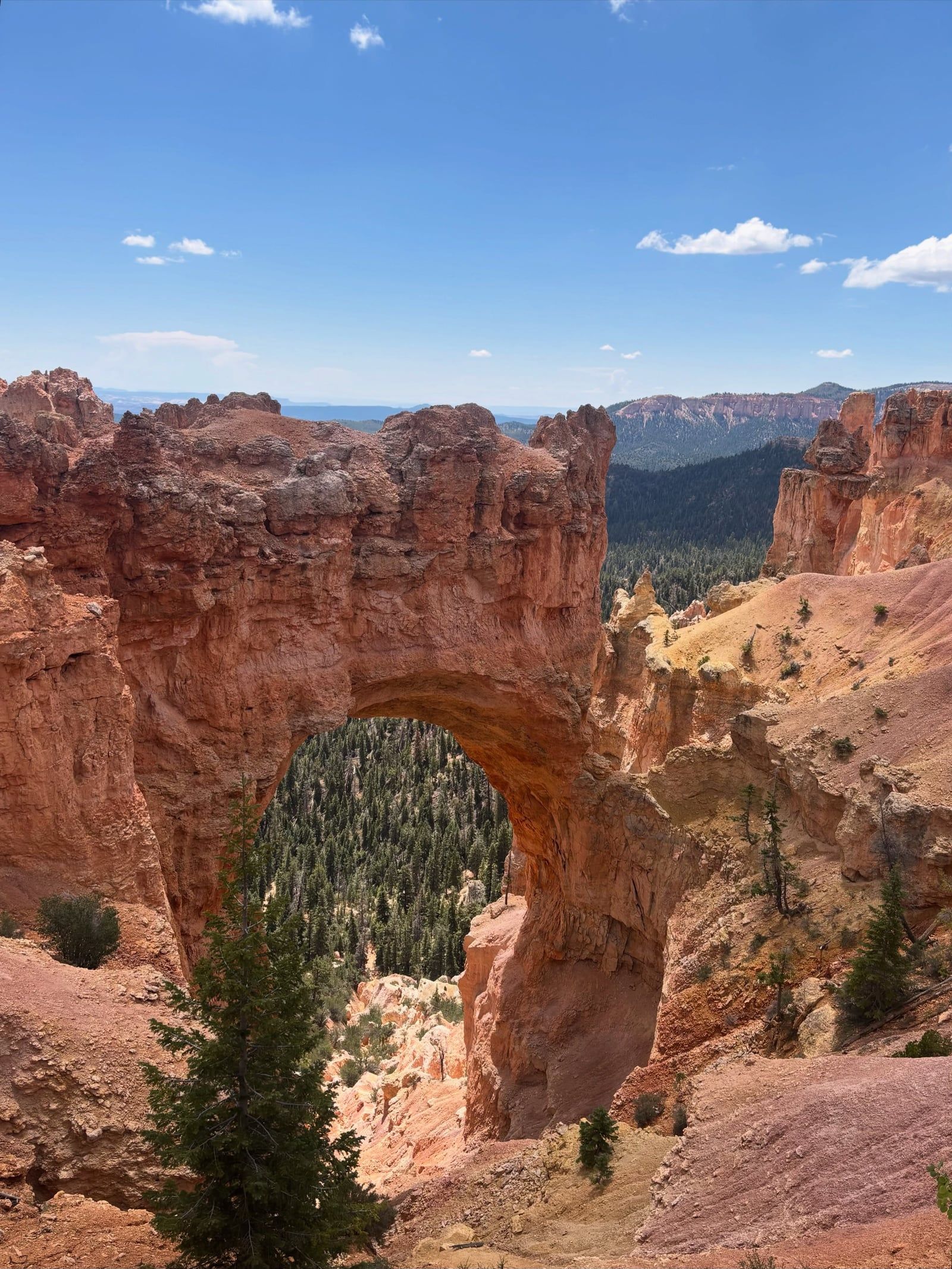
Frost-wedging and slightly acidic rainwater drive the constant geological evolution of Bryce Canyon. The park experiences over 200 freeze-thaw cycles each year due to its extreme elevation. Snowmelt seeps into vertical fractures in the Claron Formation limestone during the day, then freezes and expands at night. This mechanical weathering shatters the rock, carving narrow slot canyons and leaving behind isolated fins. Rainwater chemically dissolves the calcium carbonate binding the rock together, rounding the edges of the fins until they erode into individual spires known as hoodoos.
These hoodoos range from the size of an average human to towers exceeding 10 stories in height. Iron oxide minerals tint the lower portions deep reds and bright oranges, while manganese adds purple hues. The upper layers often contain higher concentrations of white limestone, creating a distinct color banding across the amphitheater. The Paunsaugunt Plateau itself stretches 12 miles, lifting the entire park to elevations between 8,000 and 9,115 feet. Visitors standing at Inspiration Point look down on thousands of these colorful rock spires packed tightly within the main amphitheater. The air at this altitude contains only about 70 percent of the oxygen found at sea level.
The high-altitude environment supports diverse forest ecosystems across the plateau surface. Ancient bristlecone pine trees, some thousands of years old, grow along the exposed limestone edges at Rainbow Point. Ponderosa pines dominate the lower elevations near the Visitor Center, their roots anchoring the thin topsoil. Mossy Cave Trail, located along Highway 12, features a dripping alcove and a scenic mountain stream, providing a rare water source in the arid landscape. Temperatures in this high desert environment fluctuate by as much as 50°F in a single day.
The crumbly limestone trails lack guard rails in many sections, and the soft rock frequently gives way underfoot. Hikers navigating the steep switchbacks of the Navajo Loop must wear boots with deep lug traction to maintain footing on the loose gravel. Sport-sandals and smooth-soled trainers are the leading cause of search-and-rescue operations in the park. Visitors hiking below the rim should carry at least one liter of water for every two miles traveled and consume salty snacks to combat altitude fatigue.
Native American groups inhabited the Colorado Plateau for thousands of years before European settlement. Southern Paiute people occupied the region surrounding the Paunsaugunt Plateau starting around 1200 CE. They utilized the high-altitude forests for seasonal hunting and gathering, migrating to lower elevations during the harsh winters. Paiute oral traditions explain the hoodoos as the Legend People, or To-when-an-ung-wa. According to these stories, the Legend People were animals and birds in human form who committed bad deeds. The trickster god Coyote turned them to stone as punishment. The red and orange spires represent their painted faces, frozen in time while standing in rows along the canyon walls.
The park functions today as a premier sanctuary for astronomical observation. Far from the light pollution of major cities, the night sky reaches exceptional levels of darkness. The Milky Way shines with enough clarity to cast shadows on moonless nights. Ranger-led astronomy programs draw thousands of visitors to the rim after sunset. Telescopes set up at the Visitor Center allow guests to view the rings of Saturn, the moons of Jupiter, and distant galaxies. The annual Astronomy Festival brings guest speakers and specialized equipment to the park every summer.
Local communities rely heavily on the economic engine of the national park. Bryce Canyon City, situated just outside the park entrance, developed specifically to service the millions of annual tourists. Ruby's Inn, established in 1916, remains a central hub for lodging, supplies, and guided tours. Federal law protects all natural and cultural features within these boundaries. Gathering firewood, pine cones, or pine needles is illegal, and attaching hammocks or clotheslines to trees in the campgrounds carries strict fines to protect forest health.
The towering limestone hoodoos attract frequent lightning strikes during intense July and August monsoon storms.
The park experiences over 200 freeze-thaw cycles annually, which is the primary mechanical force shaping the hoodoos.
The certified dark skies allow the Milky Way to shine brightly enough to cast visible shadows on moonless nights.
Despite its name, Bryce Canyon is actually a series of horseshoe-shaped amphitheaters carved into the edge of a plateau.
The park reaches 9,115 feet at Rainbow Point, where the atmosphere contains roughly 30 percent less oxygen than at sea level.
The Bristlecone Loop Trail features resilient pine trees that have survived the harsh 9,000-foot elevation for thousands of years.
Mule deer and small rodents in the campgrounds frequently unzip unattended backpacks to steal human food.
Bryce Canyon National Park is open 24 hours a day, 365 days a year. Certain facilities like the Sunset Campground and the park shuttle only operate seasonally from April through October. Winter storms can also cause temporary road closures.
The standard entrance fee is $35.00 per private vehicle. This pass covers all passengers for seven days and includes unlimited use of the park shuttle. Motorcyclists pay $30.00, while individual pedestrians and bicyclists are charged $20.00.
There are no advanced reservations or timed-entry systems required to enter Bryce Canyon National Park. Visitors simply pay the admission fee or present an approved annual pass at the entrance station upon arrival.
Pets are strictly restricted to paved surfaces, including campgrounds, picnic areas, paved overlooks, and the paved Rim Trail section between Sunset and Sunrise Points. They are not permitted on unpaved trails, on shuttle buses, or inside public buildings.
The free Bryce Canyon Shuttle operates daily from mid-April through mid-October. It runs every 15 to 20 minutes from 8 a.m. to 6 p.m., with extended hours to 8 p.m. in the summer. The shuttle is fully included with the standard park entrance fee.
Elevations range from 7,894 feet at the Visitor Center to a maximum of 9,115 feet at Rainbow Point. Visitors should prepare for thinner air, which contains only about 70 percent of the oxygen found at sea level.
The use of remote-controlled aircraft, including drones and helicopters, is strictly prohibited by federal law within Bryce Canyon National Park. Violating this regulation results in severe legal penalties and fines.
The hoodoos were carved from the calcium-rich mudstone of the Claron Formation over millions of years. Frost-wedging shatters the rock as freezing water expands in cracks, while slightly acidic rainwater chemically dissolves the limestone into individual spires.
The nearest full-service medical facility is the Garfield Memorial Hospital, located about 45 minutes away in Panguitch, Utah. This hospital provides 24-hour emergency care, imaging services, and an on-site pharmacy.
Federal law allows individuals who can legally possess firearms under federal, state, and local laws to carry them within the park. Firearms remain strictly prohibited inside federal facilities, such as the Visitor Center and administrative buildings.
Browse verified tours with free cancellation and instant confirmation.
Find Tours